When a hurricane changes course or a wildfire spreads faster than anticipated, the difference between chaos and coordination often comes down to a single key factor: the pre-positioning of resources, including helicopters. Natural disasters can wash out entire roads and damage critical infrastructure, preventing ground crews from delivering aid to impacted communities. In situations where ground access is impossible, helicopters often become the fastest—or sometimes the only—way to survey the damage, rescue victims, and deliver supplies.
Pre-positioning for disaster response helps operators minimize unmet demand for support and save lives during wide-scale emergencies. This blog explores how emergency response teams use predictive modeling and strategic helicopter deployment planning to stage aircraft in high-risk areas, ensuring aviation teams can provide a rapid response when and where it’s needed most.
Applications of Helicopters in Disaster Response Operations
Helicopters are uniquely capable of operating in areas where infrastructure is damaged or inaccessible, making them ideal vehicles for providing disaster relief support. Their ability to deploy quickly, land in tight spaces, and hover above dangerous terrain shows why rotorcraft are essential.
Helicopter-based support for disaster response operations includes:
- Aerial Surveillance and Damage Surveys: After a natural disaster, flight teams can quickly evaluate the damage and provide real-time visual assessments. This data helps response managers and first responders prioritize rescue efforts.
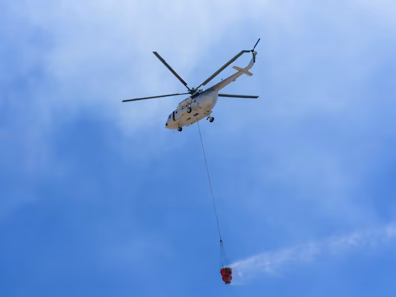
- Aerial Firefighting: Firefighting helicopters are capable of hovering over raging wildfires to deliver targeted drops of water or fire retardant onto hotspots below. They can also quickly transport firefighting crews to remote areas with limited ground access.
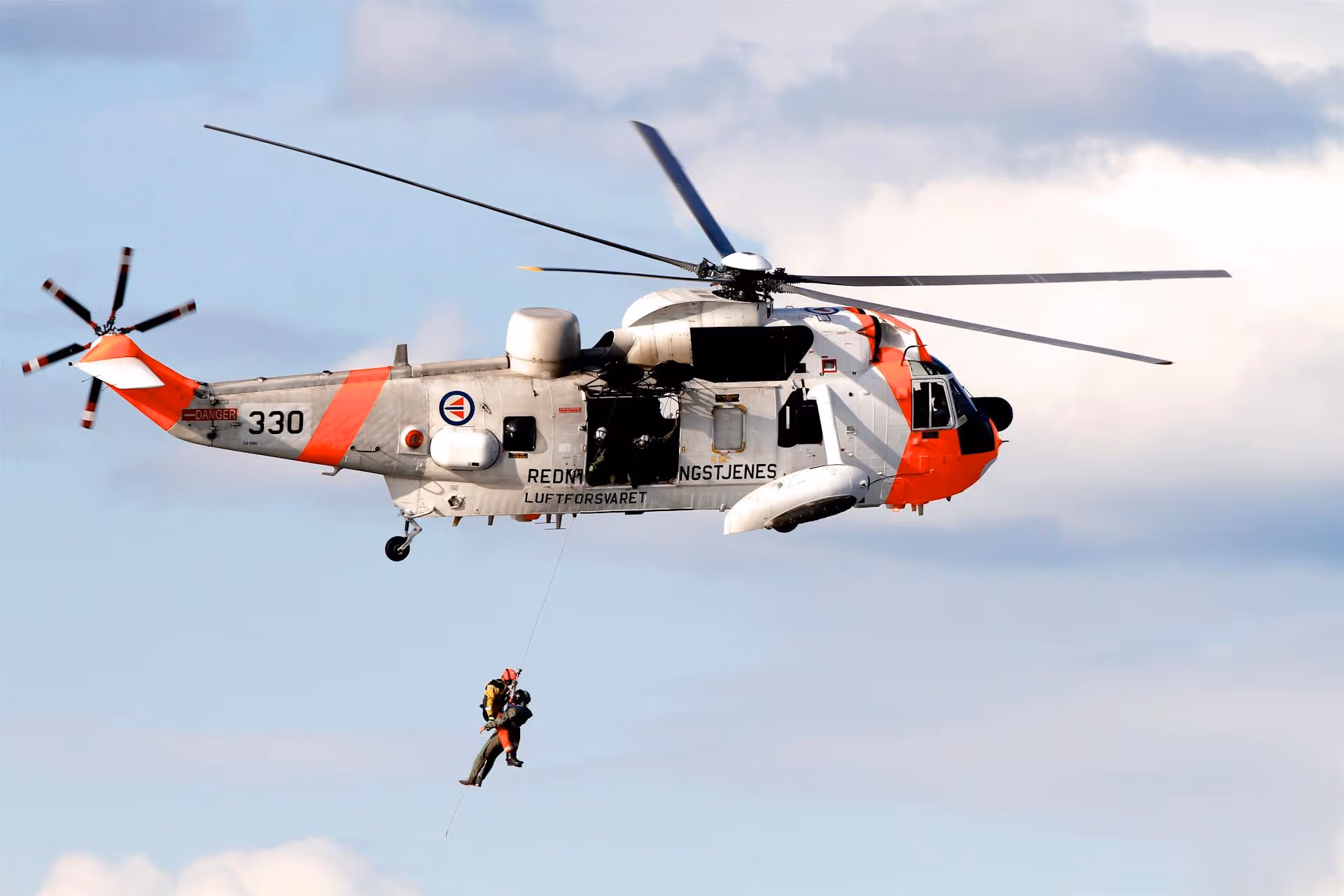
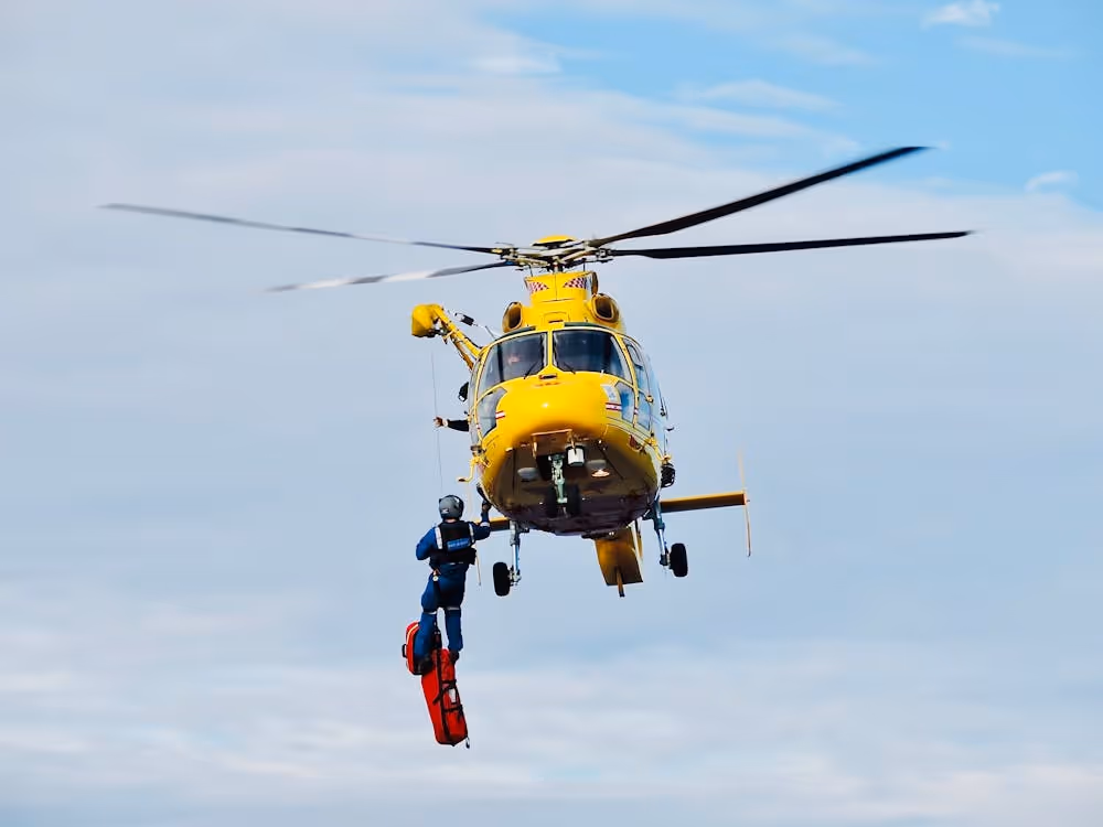
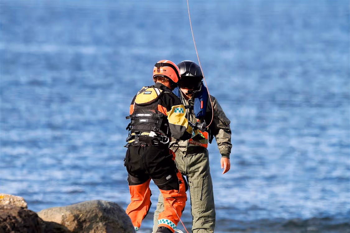
- Search and Rescue: Equipped with specialized rescue equipment, helicopters enable search and rescue responders to locate and extract victims of floods, earthquakes, hurricanes, and other disasters who are trapped or unconscious.
- Medical Evacuation: The ability of rotorcraft to quickly transport injured individuals from disaster zones to hospitals drastically reduces response times, improving patient outcomes and likelihood of survival.
- Supply Delivery: Natural disasters can leave entire communities cut off from food, water, medical supplies, and communication equipment. Helicopters can carry thousands of pounds of external cargo to deliver equipment and supplies to impacted areas.
- Support for Rebuilding and Repairs: Recovery phases often require aircraft to transport heavy equipment—such as power line components and construction materials—to help restore utilities and rebuild infrastructure.
Predictive Modeling: Knowing Where to Be
Emergency response planners are increasingly relying on predictive modeling to determine where to stage helicopters before disasters strike. Predictive modeling analyzes historical data and real-time forecasts using statistical and optimization models. This process helps determine when and where aerial support is most likely to be needed.
Key goals of predictive modeling include:
- Reducing response times after disasters occur
- Minimizing unmet demand for support through proper allocation of resources
- Preventing last-minute logistical challenges that cause stress
How Predictive Modeling Works for Disaster Response
Here’s a quick overview of the process:
- Models evaluate historical disaster data and information about previous helicopter-based missions—such as storm and flood data, statistics about past rescue missions, travel times, weather tracks, and evacuation routes—to predict the probability, timing, and locations of future disasters.
- Models then build spatial grids representing at-risk communities, complete with nearby hospitals, existing aircraft bases, locations where temporary staging areas should be established, and refueling points.
- Next, they adjust these risk maps based on real-time forecast elements, such as storm paths, rainfall estimates, and road closures. Current forecasts allow models to refine which areas are most likely to remain accessible by ground and which are likely to need aerial support.
Key Elements of Predictive Modeling
Predictive modeling relies on several analytical tools and data sources that support effective helicopter pre-positioning strategies.
- Demand Forecasting Models: Machine-learning models combine historical data analysis of past events with real-time data feeds (satellite imagery, weather systems, etc.) to predict where incidents are most likely to occur.
- Coverage and Base-Location Models: Optimization formulas evaluate potential helicopter base locations and staging sites to ensure aircraft can reach affected communities within the target response times.
- Risk and Vulnerability Mapping: Geographic information systems (GIS) incorporate data about terrain, flood zones, infrastructure networks, and population density to pre-position rotorcraft in areas where disasters are expected to have the greatest impact.
- Seasonal Planning: Seasonal risks are factored in as well, since disaster preparedness strategies can shift throughout the year. For example, hurricane-prone coastlines are more likely to demand aerial support during storm season.
- Operational Constraints: Planning models account for the realistic limits of helicopter-based support too. Limits may include fuel and maintenance needs, maximum speeds, duty-time rules for crews, and the chances of certain bases becoming damaged or unusable.
When emergency response teams know when and where disasters are most likely to occur, they can make strategic decisions ahead of time. Technology like predictive modeling helps save more lives and limit widespread destruction.
Helicopter Deployment Planning: Key Strategies and Protocols
Predictive modeling is just one element of pre-positioning for disaster response. Well-defined operational procedures and safety protocols are also crucial for the successful deployment of emergency response helicopters to high-risk areas.
Pre-Positioning
Emergency planners use risk maps and population data to identify staging locations and alternate landing zones just outside predicted impact zones. These strategic locations help disaster response helicopters and crews stay safe while keeping them close for rapid deployment.
Defining Roles and Procedures
Assigning primary roles ahead of time (damage survey, medical evacuation, logistics, etc.) and prioritizing support by mission type help prevent confusion during high-pressure situations.
Here’s the common order of mission priorities:
- Life-saving rescue operations, such as search and rescue, medical evacuation, and emergency transport
- Critical infrastructure support
- Aerial damage assessments
- Logistics support and repairs
Safety thresholds must be established in advance in regard to weather, visibility, and duty limits. Enforcement must remain even under intense media scrutiny and political pressure.
Establishing Communication Channels and Multi-Crew Coordination
Crisis response typically requires multiple agencies to operate within the same zones at the same time. Effective communication ensures all teams maintain a shared understanding of their roles and that helicopters deploy to areas where they will have the greatest impact first.
Key aspects of multi-crew communication and coordination include:
- Standardized procedures for dispatch, patient and supply handoff, triage, and landing zone control
- Coordination with fire, police, Coast Guard, and emergency services
- Communication systems (radios, satellite communication, telemetry systems, etc.) that enable pilots, ground personnel, and hospitals to stay in touch regarding evolving patient situations

Integrating With Ground and Medical Systems
Helicopter operations are most effective when aerial teams and deployment planners coordinate with ground-based emergency services. Response personnel must align flight plans with ground evacuation routes, hospitals, and shelters to efficiently move patients. Standardized triage categories and thorough documentation ensure patients receive adequate medical care and that cargo is properly tracked.
Solidifying Logistics
Logistical planning is crucial as well, since disaster response missions can last for days, weeks, or even longer. These measures help ensure helicopter operations can continue despite damage to local infrastructure.
Operational plans typically include:
- Planned network of operating bases and refueling sites
- Establishment of fuel transport trucks and backup suppliers
- On-site maintenance teams and essential spare parts
- Airspace coordination to prevent conflicts with other aircraft and drones in the area
Conducting Ongoing Risk Assessments
Conditions in disaster zones can turn on a dime. Pilots, aerial teams, and ground-based teams must continually evaluate hazards such as:
- Downed power lines and wires
- Unstable roads, buildings, and other infrastructure
- Smoke
- Debris
Post-Mission Debriefing
At the conclusion of each disaster relief mission, agencies and operators should analyze performance data and conduct detailed debriefings with crews.
These assessments help planners:
- Refine staging locations and deployment plans
- Update communication procedures
- Improve coordination across agencies
Ongoing Disaster Response Training
Ongoing training via large-scale exercises helps ensure agencies can coordinate effectively and respond quickly during real-world emergencies. Simulated scenarios like hurricanes, earthquakes, wildfires, and floods allow teams to practice operating in high-stress scenarios that include damaged infrastructure and limited communications.

Helicopter Express: Experienced, Reliable Support for Disaster Relief Missions
At Helicopter Express, we understand that every second counts in emergency situations like search and rescue missions or disaster strikes. That’s why our team of highly skilled pilots, state-of-the-art aircraft, and dedicated support staff remain on standby to respond to rescue calls.
With over two decades of experience, we have established ourselves as a trusted disaster response partner. Whether evacuating patients from remote locations or rescuing climbers stranded on treacherous peaks, our team delivers rapid, reliable support when it matters most.
Emergency Response Capabilities
The fleet and crews at Helicopter Express are equipped to assist with a wide range of disaster relief activities, including:
- Rapid deployment of heavy-lift helicopters into areas inaccessible by ground vehicle
- Aerial assessments for evaluating damage and prioritizing response efforts
- Search and rescue and medical evacuation to locate and transport victims who are injured or trapped
- Aerial firefighting to help stop the spread of wildfires
- Logistics and supply transport to deliver aid to communities cut off by flooding, landslides, or storm damage
- Infrastructure repair and utility restoration after storms and wildfires have damaged power lines and critical infrastructure
- Rebuilding efforts once rescue operations are complete
Dependable Expertise You Can Count On
Helicopter Express’ steadfast commitment to safety, reliability, and customer satisfaction is the driving force behind our success and legacy. With a modern fleet, experienced crews, and a collaborative approach to mission planning, we’re prepared to support your complex aerial operation wherever we’re needed.
Contact us today to discuss your project. We’ll show you how our team can help advance your mission with dependable expertise and reliability.