How Helicopters Support Flood Monitoring and Response

Learn how helicopter services support flood monitoring and response through river gauge checks, ice jam assessments, and levee inspections when ground access is limited.

Flash floods are one of the deadliest weather hazards in the United States, claiming more lives than tornadoes or lightning in an average year. Not only are flash floods incredibly powerful — a mere six inches of fast-moving water can knock people off their feet — but they’re one of the most unpredictable severe storm hazards.

When floodwaters rise, the roads and bridges needed to evaluate damage are often the first infrastructure to disappear underwater. Reduced ground access means agencies need another way to determine what’s happening so they can allocate resources and respond. Helicopters close these critical gaps by providing a bird’s-eye view of flood conditions and surrounding areas.

Learn about the applications and benefits of helicopter services for flood monitoring and response, including how they enable river gauge readings, ice jam assessments, and levee inspections during various stages of flooding.

Key Benefits of Helicopter Services for Flood Monitoring and Response

Flooding from storm surges, heavy rainfall, and hurricanes is becoming more frequent and severe, and helicopters are increasingly crucial for flood response efforts. When flooding is predicted, they’re often pre-positioned to enable quicker response. These versatile aircraft can also be rapidly deployed to active flood events.

Several advantages make helicopters a valuable complement to traditional flood monitoring and response methods:

  • Access to Hard-to-Reach Areas: Flooding often limits access to waterways and infrastructure, making roads, bridges, and other ground routes difficult or impossible to navigate. Helicopters can reach remote or isolated locations, gather information from multiple sites during a single flight, and respond despite these limitations.

  • Flexible Deployment: Helicopters can accommodate different monitoring needs based on location, terrain, and mission requirements. Helicopter Express operates a diverse fleet of utility aircraft designed to accommodate many types of operational requirements.

  • Broad View of Current Conditions: An aerial perspective allows crews to survey larger areas and observe changes in waterways, infrastructure, ice, and debris from a single flight. These observations supplement established monitoring and forecasting systems and provide valuable context around individual gauge readings and monitoring points.

  • Data Capture for Time-Sensitive Decisions: Flood managers need real-time information to determine if and where additional surveys, road closures, warnings, and emergency resources are needed. During major flooding disasters, emergency helicopter operators help agencies reach isolated or hazardous areas to collect the data response managers need to effectively respond to evolving conditions.

This combination of capabilities makes helicopters a valuable complement to established flood monitoring and response systems, particularly when conditions reduce access or require timely overhead observations.

orange and white rescue helicopter flying over the vast ocean
Photo by Tanhauser Vázquez R. from Pexels

Monitoring River Gauges From the Air

When flooding is predicted or during flood events, helicopters enable airborne crews to reach isolated rivers in remote locations to verify that river gauges are functioning properly and capture critical readings. River gauges are tools that keep track of water levels and help determine where flooding may occur. Helicopters support gauge readings and river monitoring in several key ways.

Reaching Gauges During Flood Conditions

High water can make individual monitoring stations difficult or unsafe to reach by vehicle. Even during active flooding, helicopter crews can access river gauges located along isolated stretches of rivers. Regular gauge readings, aerial photographs, and time- and location-specific metadata help levee patrols confirm conditions and spot hazardous areas where additional inspections are needed.
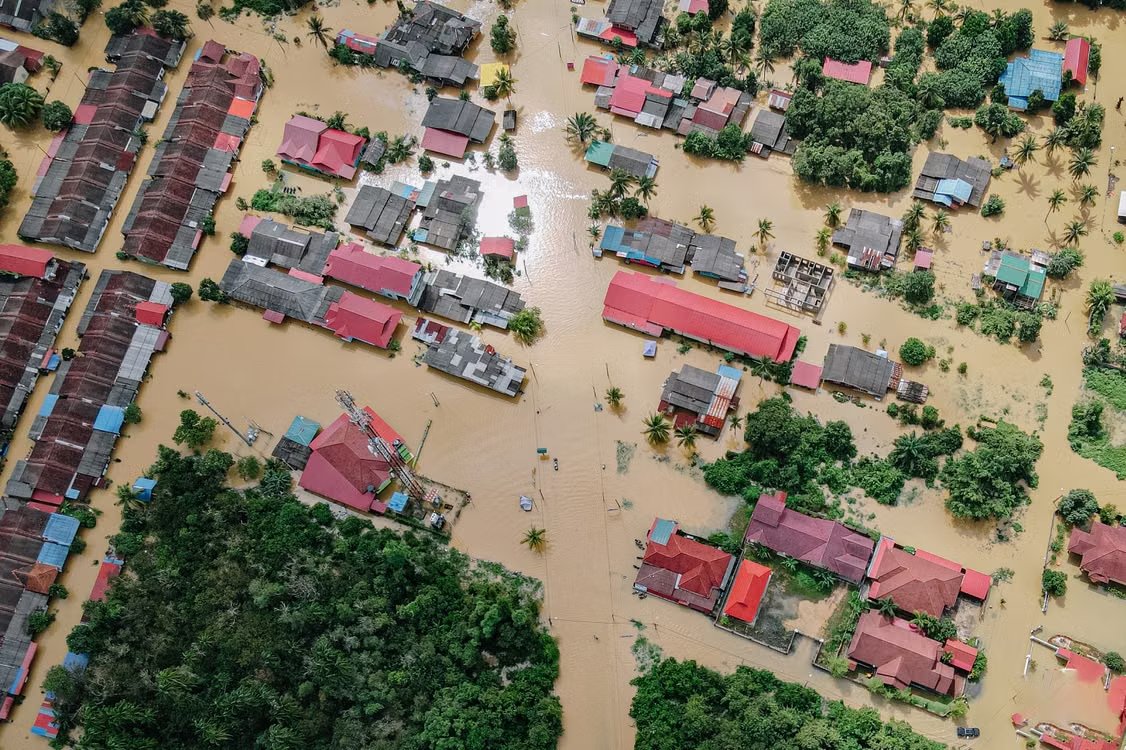
aerial shot showing a residential neighborhood submerged in floodwater after torrential rains
Photo by Pok Rie from Pexels

Evaluating Conditions Around Gauge Stations

Helicopters don’t replace the need for automated gauges or river monitoring. Instead, they provide broader context about the conditions surrounding each river. While a gauge collects measurements from a single location, helicopter-based surveys capture the river, flood, and reservoir inflow data agencies need to contextualize and verify information collected from individual monitoring stations.

Aerial assessments of conditions surrounding gauge stations help identify:

  • Flow direction
  • Tributary inflows
  • Debris accumulation
  • Obstructions affecting water flow
  • Rising or unusually high water
  • Erosion around riverbanks
  • Damage to nearby infrastructure
  • Changes in the surrounding floodplain

This information helps agencies determine where closer inspections are warranted without deploying unnecessary resources.

Identifying Malfunctioning Gauges

Sometimes, a helicopter crew is deployed to determine if an automated station is functioning properly and whether its readings are representative of actual river conditions.

When a gauge malfunctions, airborne personnel can quickly detect the reason:

  • Damage to the gauge house
  • Ice buildup
  • Debris at the sensor
  • Another issue

Helicopter data helps confirm whether gauge readings match conditions on the ground.

Assessing Ice Jams Before They Cause Major Flooding

Also called ice dams, ice jams occur when chunks of ice accumulate to block the flow of a river. These large clumps act as temporary dams, restricting river flow and quickly raising water levels before releasing a sudden surge of water downstream. This release can cause flooding that threatens nearby communities and infrastructure.

Unfortunately, ice jams can be hard for ground teams to identify due to limited visibility into the blockage location and extent. Conditions can also change rapidly as ice shifts and pieces break apart. Agencies like the National Weather Service often work with helicopter operators to help find and provide further insight into areas of concentrated ice.

Locating and Inspecting Ice

Because of their long range and ability to hover, helicopters are particularly useful for locating and evaluating ice jams. Flight crews can survey long stretches of river more efficiently than ground crews, hover for observation, and make repeated passes over critical features to help teams observe how ice jams are developing.

Helicopter surveys help agencies identify:

  • The location and extent of an ice jam
  • Ice movement, freeze-up, and breakup progression
  • Constrictions such as bends, islands, and bridges that encourage jamming
  • Changes in water flow
  • Whether water is backing up or bypassing the blockage
  • Potential areas of concern downstream
  • Risk to roads, bridges, levees, other infrastructure, and homes

These observations give flood managers a clearer picture of where ice-related flooding could occur and impact both people and infrastructure.

snow and ice covered river lined with trees along a railroad track showing potential for an ice jam and flooding
Photo by Marko Blažon from Pexels

Aiding Monitoring and Response

The high-resolution data, maps, and images captured through helicopter surveys can be georeferenced and delivered to hydrologists and incident managers. While agencies do not rely solely on these observations to predict if and when an ice jam will break, they do use it to supplement ground-based data and make more informed decisions.

More thorough analysis aids:

  • Short-term awareness of developing flood events
  • Detection of areas requiring closer inspection
  • Identification of downstream risks
  • Prioritization of response

Flood risk isn’t limited to natural waterways like rivers. Helicopter crews often take to the skies to evaluate other infrastructure designed to control water flow as well, such as levees and dams.

Inspecting Levees From Above

A levee is a manmade barrier built to reduce flooding frequency within a portion of a floodplain. Because levee conditions can differ before, during, and after a flood, helicopter surveys help agencies track conditions throughout the entire flood cycle.

These aircraft provide critical support during three stages of levee inspection:

  • Before Flooding: Helicopters help establish baseline conditions and flag potential concerns.

  • During Flooding: Aerial teams observe and monitor water levels, overtopping, erosion, and other visible changes.

  • After Flooding: Flood management teams often rely on data captured during flight to document damage and note areas requiring further assessment or repair.

This staged approach helps track shifting levee conditions as flood risks evolve.

Covering Long Levee Systems Efficiently

Levees can extend for miles and cross challenging terrain such as wetlands, farmland, and waterways.

Helicopters enable crews to:

  • Perform quick, wide-area scans over large sections, preventing inspectors from having to drive the length of the levee
  • Flag high-consequence areas in need of repair
  • Make repeated passes over priority areas to track conditions

This coverage allows teams to focus ground inspections and maintenance efforts on the areas that require the most attention.
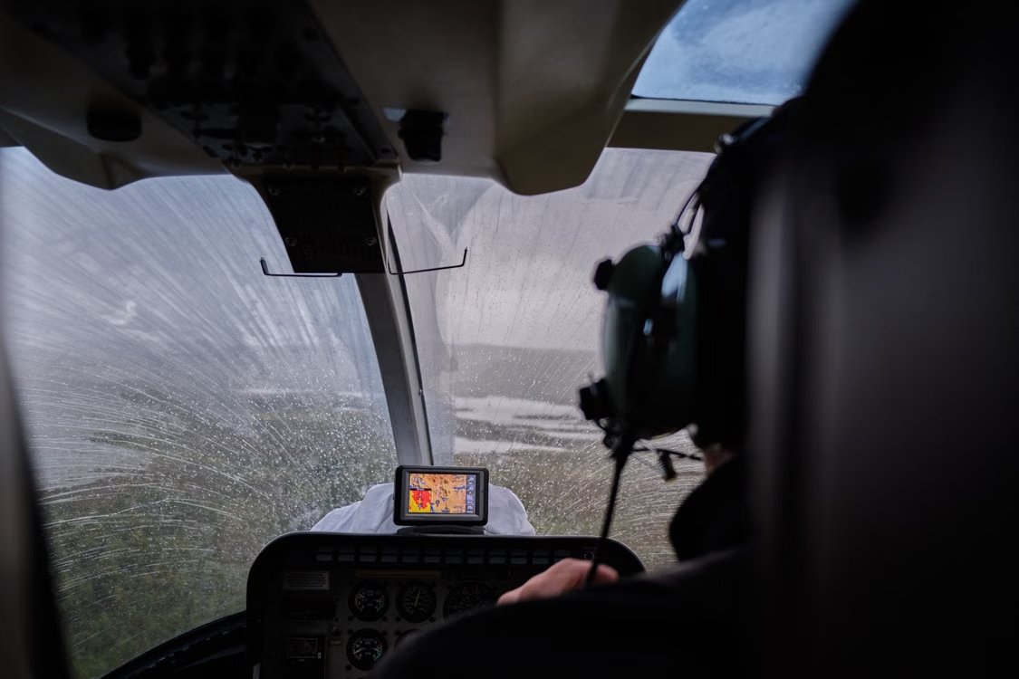
inside view of a helicopter cockpit and navigation system as the pilot flies over a flooded landscape during rain
Photo by Sidde from Pexels

Detecting Visible Damage

Using advanced navigation systems like geographic information systems (GIS) and global positioning systems (GPS), helicopter teams can fly repeatable, georeferenced routes to quickly identify and photograph known gauges and high-consequence levee points. Along with data regarding time, location, and defect severity, these images are added to inspection and response records to help workers and engineers on the ground prioritize response.

Potential visible issues that can be seen from overhead include:

  • Standing, overtopping, or dangerously low water
  • Breaches and developing flow paths
  • Washouts, bank caving, slope instability, and erosion
  • Debris buildup, vegetation, and other conditions obscuring the levee
  • Concentrated seepage, sand boils, and distress around floodwalls or drainage structures
  • Structural damage to adjacent transportation or utility infrastructure

Not every structural defect can be detected from a helicopter, but these versatile aircraft save time by helping personnel spot visible symptoms of damage.

Make Faster, Smarter Flood Decisions With the Experts at Helicopter Express

Helicopters serve as the eyes in the sky that help flood managers and emergency response agencies quickly evaluate conditions, prioritize inspections, and take action during flood events. Whether verifying river gauge readings or surveying miles and miles of levee infrastructure, helicopter services can capture critical data in hard-to-reach locations that aid flood management teams and authorities on the ground.

Georgia-based Helicopter Express brings decades of airborne experience and a diverse fleet to aerial flood monitoring operations, helping agencies respond with urgency during unpredictable conditions. Reach out to our team to request a quote or learn how we can support your next flood-related mission.

How Helicopters Support Flood Monitoring and Response

Flash floods are one of the deadliest weather hazards in the United States, claiming more lives than tornadoes or lightning in an average year. Not only are flash floods incredibly powerful — a mere six inches of fast-moving water can knock people off their feet — but they’re one of the most unpredictable severe storm hazards.

When floodwaters rise, the roads and bridges needed to evaluate damage are often the first infrastructure to disappear underwater. Reduced ground access means agencies need another way to determine what’s happening so they can allocate resources and respond. Helicopters close these critical gaps by providing a bird’s-eye view of flood conditions and surrounding areas.

Learn about the applications and benefits of helicopter services for flood monitoring and response, including how they enable river gauge readings, ice jam assessments, and levee inspections during various stages of flooding.

Key Benefits of Helicopter Services for Flood Monitoring and Response

Flooding from storm surges, heavy rainfall, and hurricanes is becoming more frequent and severe, and helicopters are increasingly crucial for flood response efforts. When flooding is predicted, they’re often pre-positioned to enable quicker response. These versatile aircraft can also be rapidly deployed to active flood events.

Several advantages make helicopters a valuable complement to traditional flood monitoring and response methods:

  • Access to Hard-to-Reach Areas: Flooding often limits access to waterways and infrastructure, making roads, bridges, and other ground routes difficult or impossible to navigate. Helicopters can reach remote or isolated locations, gather information from multiple sites during a single flight, and respond despite these limitations.

  • Flexible Deployment: Helicopters can accommodate different monitoring needs based on location, terrain, and mission requirements. Helicopter Express operates a diverse fleet of utility aircraft designed to accommodate many types of operational requirements.

  • Broad View of Current Conditions: An aerial perspective allows crews to survey larger areas and observe changes in waterways, infrastructure, ice, and debris from a single flight. These observations supplement established monitoring and forecasting systems and provide valuable context around individual gauge readings and monitoring points.

  • Data Capture for Time-Sensitive Decisions: Flood managers need real-time information to determine if and where additional surveys, road closures, warnings, and emergency resources are needed. During major flooding disasters, emergency helicopter operators help agencies reach isolated or hazardous areas to collect the data response managers need to effectively respond to evolving conditions.

This combination of capabilities makes helicopters a valuable complement to established flood monitoring and response systems, particularly when conditions reduce access or require timely overhead observations.

orange and white rescue helicopter flying over the vast ocean
Photo by Tanhauser Vázquez R. from Pexels

Monitoring River Gauges From the Air

When flooding is predicted or during flood events, helicopters enable airborne crews to reach isolated rivers in remote locations to verify that river gauges are functioning properly and capture critical readings. River gauges are tools that keep track of water levels and help determine where flooding may occur. Helicopters support gauge readings and river monitoring in several key ways.

Reaching Gauges During Flood Conditions

High water can make individual monitoring stations difficult or unsafe to reach by vehicle. Even during active flooding, helicopter crews can access river gauges located along isolated stretches of rivers. Regular gauge readings, aerial photographs, and time- and location-specific metadata help levee patrols confirm conditions and spot hazardous areas where additional inspections are needed.

aerial shot showing a residential neighborhood submerged in floodwater after torrential rains
Photo by Pok Rie from Pexels

Evaluating Conditions Around Gauge Stations

Helicopters don’t replace the need for automated gauges or river monitoring. Instead, they provide broader context about the conditions surrounding each river. While a gauge collects measurements from a single location, helicopter-based surveys capture the river, flood, and reservoir inflow data agencies need to contextualize and verify information collected from individual monitoring stations.

Aerial assessments of conditions surrounding gauge stations help identify:

  • Flow direction
  • Tributary inflows
  • Debris accumulation
  • Obstructions affecting water flow
  • Rising or unusually high water
  • Erosion around riverbanks
  • Damage to nearby infrastructure
  • Changes in the surrounding floodplain

This information helps agencies determine where closer inspections are warranted without deploying unnecessary resources.

Identifying Malfunctioning Gauges

Sometimes, a helicopter crew is deployed to determine if an automated station is functioning properly and whether its readings are representative of actual river conditions.

When a gauge malfunctions, airborne personnel can quickly detect the reason:

  • Damage to the gauge house
  • Ice buildup
  • Debris at the sensor
  • Another issue

Helicopter data helps confirm whether gauge readings match conditions on the ground.

Assessing Ice Jams Before They Cause Major Flooding

Also called ice dams, ice jams occur when chunks of ice accumulate to block the flow of a river. These large clumps act as temporary dams, restricting river flow and quickly raising water levels before releasing a sudden surge of water downstream. This release can cause flooding that threatens nearby communities and infrastructure.

Unfortunately, ice jams can be hard for ground teams to identify due to limited visibility into the blockage location and extent. Conditions can also change rapidly as ice shifts and pieces break apart. Agencies like the National Weather Service often work with helicopter operators to help find and provide further insight into areas of concentrated ice.

Locating and Inspecting Ice

Because of their long range and ability to hover, helicopters are particularly useful for locating and evaluating ice jams. Flight crews can survey long stretches of river more efficiently than ground crews, hover for observation, and make repeated passes over critical features to help teams observe how ice jams are developing.

Helicopter surveys help agencies identify:

  • The location and extent of an ice jam
  • Ice movement, freeze-up, and breakup progression
  • Constrictions such as bends, islands, and bridges that encourage jamming
  • Changes in water flow
  • Whether water is backing up or bypassing the blockage
  • Potential areas of concern downstream
  • Risk to roads, bridges, levees, other infrastructure, and homes

These observations give flood managers a clearer picture of where ice-related flooding could occur and impact both people and infrastructure.

snow and ice covered river lined with trees along a railroad track showing potential for an ice jam and flooding
Photo by Marko Blažon from Pexels

Aiding Monitoring and Response

The high-resolution data, maps, and images captured through helicopter surveys can be georeferenced and delivered to hydrologists and incident managers. While agencies do not rely solely on these observations to predict if and when an ice jam will break, they do use it to supplement ground-based data and make more informed decisions.

More thorough analysis aids:

  • Short-term awareness of developing flood events
  • Detection of areas requiring closer inspection
  • Identification of downstream risks
  • Prioritization of response

Flood risk isn’t limited to natural waterways like rivers. Helicopter crews often take to the skies to evaluate other infrastructure designed to control water flow as well, such as levees and dams.

Inspecting Levees From Above

A levee is a manmade barrier built to reduce flooding frequency within a portion of a floodplain. Because levee conditions can differ before, during, and after a flood, helicopter surveys help agencies track conditions throughout the entire flood cycle.

These aircraft provide critical support during three stages of levee inspection:

  • Before Flooding: Helicopters help establish baseline conditions and flag potential concerns.

  • During Flooding: Aerial teams observe and monitor water levels, overtopping, erosion, and other visible changes.

  • After Flooding: Flood management teams often rely on data captured during flight to document damage and note areas requiring further assessment or repair.

This staged approach helps track shifting levee conditions as flood risks evolve.

Covering Long Levee Systems Efficiently

Levees can extend for miles and cross challenging terrain such as wetlands, farmland, and waterways.

Helicopters enable crews to:

  • Perform quick, wide-area scans over large sections, preventing inspectors from having to drive the length of the levee
  • Flag high-consequence areas in need of repair
  • Make repeated passes over priority areas to track conditions

This coverage allows teams to focus ground inspections and maintenance efforts on the areas that require the most attention.

inside view of a helicopter cockpit and navigation system as the pilot flies over a flooded landscape during rain
Photo by Sidde from Pexels

Detecting Visible Damage

Using advanced navigation systems like geographic information systems (GIS) and global positioning systems (GPS), helicopter teams can fly repeatable, georeferenced routes to quickly identify and photograph known gauges and high-consequence levee points. Along with data regarding time, location, and defect severity, these images are added to inspection and response records to help workers and engineers on the ground prioritize response.

Potential visible issues that can be seen from overhead include:

  • Standing, overtopping, or dangerously low water
  • Breaches and developing flow paths
  • Washouts, bank caving, slope instability, and erosion
  • Debris buildup, vegetation, and other conditions obscuring the levee
  • Concentrated seepage, sand boils, and distress around floodwalls or drainage structures
  • Structural damage to adjacent transportation or utility infrastructure

Not every structural defect can be detected from a helicopter, but these versatile aircraft save time by helping personnel spot visible symptoms of damage.

Make Faster, Smarter Flood Decisions With the Experts at Helicopter Express

Helicopters serve as the eyes in the sky that help flood managers and emergency response agencies quickly evaluate conditions, prioritize inspections, and take action during flood events. Whether verifying river gauge readings or surveying miles and miles of levee infrastructure, helicopter services can capture critical data in hard-to-reach locations that aid flood management teams and authorities on the ground.

Georgia-based Helicopter Express brings decades of airborne experience and a diverse fleet to aerial flood monitoring operations, helping agencies respond with urgency during unpredictable conditions. Reach out to our team to request a quote or learn how we can support your next flood-related mission.

Make us your go-to team.

Our highly skilled pilots have the experience and equipment needed to rise to any challenge. When you need experts you can trust, give us a call.