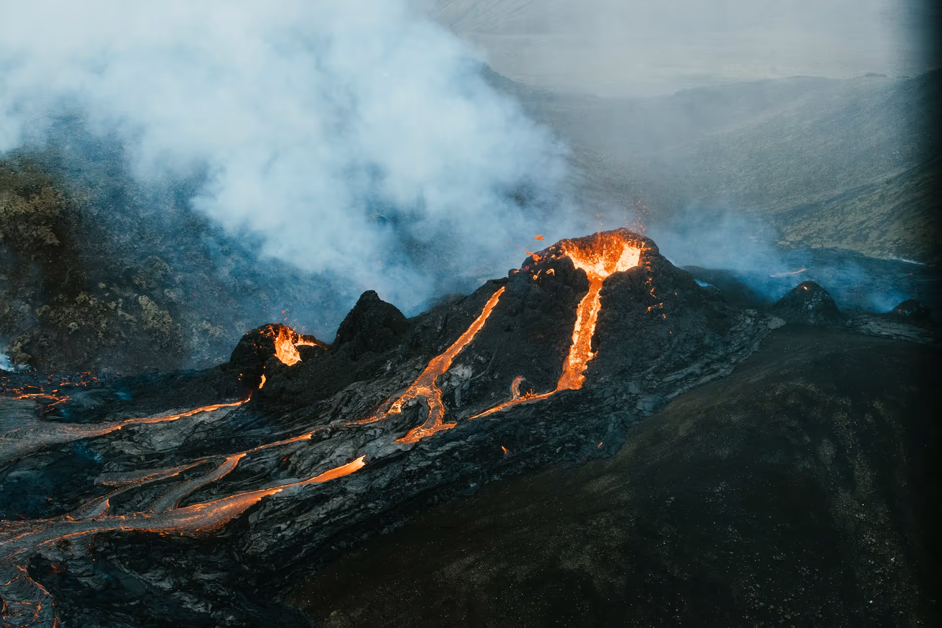
Volcanoes are among Earth’s most extreme landscapes, featuring scorching heat, towering ash plumes, and rivers of hot lava. While both fascinating and beautiful, volcanic eruptions pose significant threats to lives, property, and surrounding ecosystems. And though eruptions may seem rare, between 67–83 volcanoes have erupted each year since 2000, with 64 eruptions recorded in 2024 alone.
Fortunately, most eruptions are preceded by weeks (or even months) of increasing unrest, giving scientists a critical window to act. With the right tools and expert analysis, volcanologists can detect warning signs and use them to forecast eruptions.
Below, we’ll share the practical applications of helicopters for volcano monitoring, from aerial surveys and remote field experiments to gas sampling, thermal imaging, and LiDAR mapping. You’ll learn how helicopters support more efficient volcano monitoring, how they operate safely in extreme temperatures, and why partnering with an expert team like Helicopter Express ensures mission success.
Practical Applications of Helicopters for Volcano Monitoring
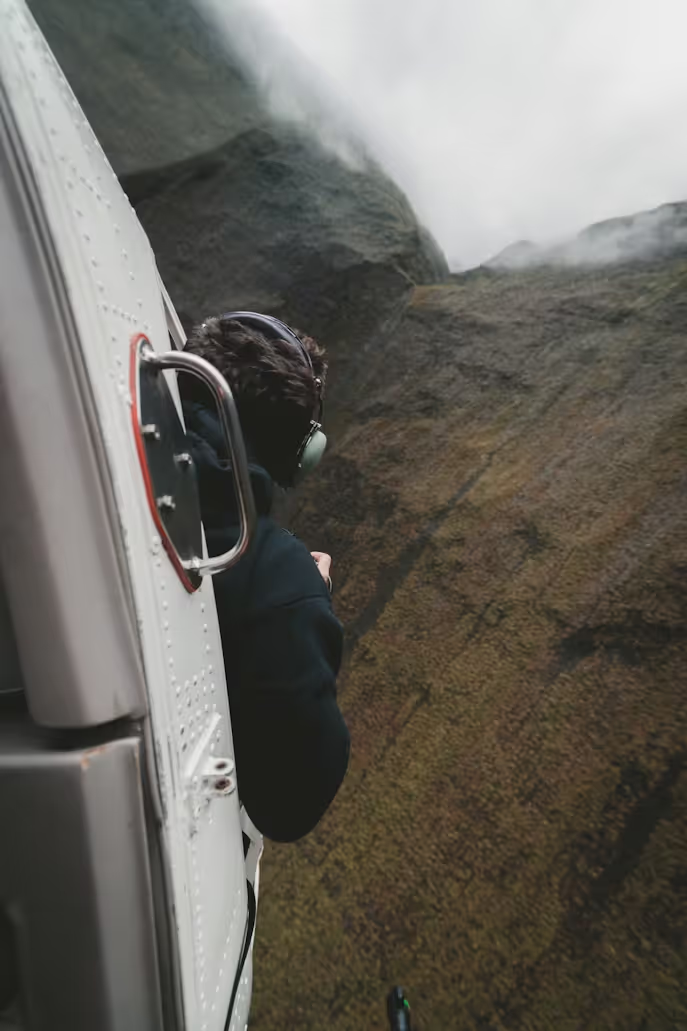
Helicopters give scientists like volcanologists, seismologists, and geologists the ability to safely observe and map volcanic activity — even in environments that are too dangerous to reach on foot. They’re capable of transporting essential tools and providing access to data that makes modern volcano monitoring more accurate, efficient, and life-saving.
Let’s dive into how helicopters support aerial surveys, instrument deployment, gas sampling, thermal imaging, LiDAR mapping, remote field experiments, and emergency response planning.
Aerial Surveys and Direct Observation
Regular helicopter reconnaissance flights around volcanoes during volcanic activity or periods of increased seismicity enable volcanologists to monitor critical changes and map activity deposits. Through visual observations, photography with digital cameras, and photogrammetry, scientists are able to extract crucial data to determine:
- Dome growth
- The extent of the eruption
- The direction of lava flows
- Ash emission locations
- Rockfall and pyroclastic flow activity
Instrument Deployment
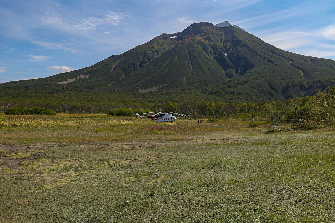
Helicopters can reach remote areas quickly and transport research teams to areas that would be difficult — or even impossible — to access via other means. In areas with ongoing eruptions or rugged terrain, helicopters allow researchers to sling, drop, or land in order to install, maintain, and repair volcano monitoring stations and instruments.
These instruments often include:
- Portable seismic networks (also referred to as “spiders”)
- Webcams
- GPS receivers
- Gas sensors
- Seismometers
- Thermal cameras
Advanced tools like these are capable of transmitting continuous data that enables the monitoring of seismic activity, temperature changes, gas emissions, and ground deformation. These insights reveal vital information about ongoing and future volcanic activity.
The use of these instruments also minimizes the environmental impact of volcano monitoring expeditions, improves their efficiency, and reduces risk to ground-based teams.
Gas Sampling Operations
Helicopters also make it possible for volcanologists to conduct airborne gas sampling operations in highly volatile and difficult-to-reach areas so they can determine the quantity of gas each volcano emits on a daily basis. Both helicopters and volcanoes themselves can be equipped with advanced sensors that measure:
- Sulfur dioxide
- Carbon dioxide
- Hydrogen chloride
Scientists analyze these readings and evaluate whether the chemical changes shown signal increasing unrest or eruption potential. These sampling missions often reveal higher-than-anticipated gas outputs that could indicate a high likelihood of eruption, which is vital information for evacuation and emergency response preparation. For example, helicopter-mounted sensors recently alerted a Montserrat-based research team that carbon dioxide emissions at Soufrière Hills Volcano were three times higher than previous studies had revealed.
Thermal Imaging
Thermal imaging cameras are the gold standard for obtaining non-contact temperature readings from a safe distance to support analysis of volcanic heat patterns. This imaging method uses specialized infrared cameras, mounted on helicopters, to record and quantify radiated heat. This heat is then converted into temperature measurements, and the results are displayed as thermal images. Researchers use these images to map heat patterns around lava domes, flows, and fumaroles.
Thermal image heat mapping enables volcanologists to:
- Detect cracks where hot gases escape
- Measure and map lava flows
- Identify hotspots
- Understand eruption dynamics
- Improve volcanic hazard warning systems
LiDAR Mapping
Light Detection and Ranging (LiDAR) mapping is one of the most accurate and precise techniques for volcanologists creating detailed maps of volcanoes and their surrounding environments.
Once mounted upon helicopters, these devices emit laser pulses and measure how long it takes for the light to bounce back after hitting an object. The laser pulses capture data about the shape and structure of a volcano’s surrounding terrain. These measurements are then processed to create high-resolution 3D maps of volcanic terrain, revealing to scientists what is invisible to the naked eye.
Helicopter LiDAR can survey large and otherwise inaccessible areas quickly, making it ideal for mapping active or hazardous volcanic terrain. This technology supports volcano monitoring operations in a few key ways:
- Topographical Change Identification: Helicopter LiDAR compares high-precision maps over time to detect changes in landforms that could present a hazard, such as sudden collapse or landslides. Identifying changes like eruption craters, lava flows, and ground deformation is indispensable for hazard modeling and evacuation planning.
- Volcanic Ash Detection: Helicopter-mounted lidar systems can remotely detect and measure airborne volcanic ash, which is essential for both aviation safety and air quality monitoring.
- Emergency Response Support: LiDAR data enables emergency response planners to pinpoint impacted zones, direct evacuation efforts, and design routes to safeguard critical infrastructure.
Remote Field Experiments
Helicopters also enable novel field experiments, like dropping sensors to study a volcano’s subsurface properties using seismic waves or deploying instruments to measure gas emissions in otherwise inaccessible areas. These experiments provide valuable data on volcanic structure and terrain, helping researchers improve eruption forecasts and refine hazard assessments.
Emergency Response Planning and Evacuation Efforts
Helicopters support emergency response preparation and facilitate lifesaving evacuation operations during volcanic eruptions in several ways:
- Provide Real-Time Assessments: Aerial surveys capture gas emissions, thermal activity, ash plumes, and lava flow movements while maintaining remote monitoring stations that are dangerous or inaccessible by land. This real-time intelligence helps scientists and authorities track evolving hazards and adapt response plans as conditions change.
- Perform Lifesaving Evacuations: When unrest escalates or eruptions occur, helicopters carry out targeted evacuations for individuals who are vulnerable, injured, or isolated. They also scout safe evacuation routes, deliver essential supplies, and transport search-and-rescue teams. Helicopters are often the only viable option when roads, bridges, or infrastructure are compromised by lava or ash.
- Guide Decisions That Support Public Safety: Thermal imaging, topographic mapping, and other airborne data inform hazard zoning, road closures, and the timing of large-scale evacuation orders. By giving authorities rapid, high-quality intelligence, helicopters enable decisive action that protects at-risk communities.
How Helicopters Support Safer, Smarter Volcano Monitoring
Helicopters play a crucial role in modern volcano monitoring. Their combination of speed, precision, and versatility enables researchers to gather data safely and effectively in some of the world’s most extreme environments.
Here are six key advantages of hiring a helicopter charter company to assist on your next high-temperature volcano monitoring expedition:
- Increased Accessibility: Helicopters can reach rugged and remote volcanoes that are often impossible to access on foot or by vehicle. This opens up opportunities for observation and data collection in hazardous areas previously off-limits to researchers.
- Enhanced Safety: Crews can monitor dangerous volcanic features (lava domes, vents, gas plumes, and more) from a safe distance, reducing the risks that come with ground-based fieldwork.
- Improved Data Collection: Helicopters can be equipped with advanced tools like LiDAR, thermal cameras, and gas sensors that deliver high-resolution measurements. This data improves the scientific community’s understanding of volcanoes and supports hazard forecasting.
- Boosted Frequency: Aerial monitoring is quick and efficient. Helicopter-based missions allow teams of volcanologists to conduct surveys more often, which is paramount for tracking sudden changes in volcanic activity and responding prior to eruption.
- Minimal Environmental Impact: Because helicopters have a long range and are capable of flying overhead and hovering when needed, they don’t require research teams to build roads, trails, or permanent monitoring stations. This reduced need for disruptive infrastructure helps preserve sensitive volcanic ecosystems.
- Rapid Emergency Response: Helicopters are able to deploy quickly in the event of an eruption. They are capable of rapidly assessing hazards, guiding evacuations, and supporting emergency operations in real time.

The Dangers of Operating Helicopters in Extreme Heat
Flying helicopters near active or restless volcanoes exposes pilots and aircraft to extreme heat conditions. From hot air reducing lift and engine power to the toll of heat stress on pilots, these challenges make volcanic environments some of the most demanding places to fly:
- Decreased Lift: Rotor blades generate less lift in hot temperatures, as hot air is less dense than cool air. This means helicopters may face more difficulties taking flight and staying airborne.
- Reduced Engine Power: In high temperatures, thinner air and reduced oxygen make it harder for helicopter engines to generate thrust. This can result in less overall power and a reduced ability to safely carry heavy loads.
- System Overheating: Aircraft components (engines, hydraulics, navigation systems, and communication systems) are vulnerable to extreme heat. Overheating can cause malfunctions or complete failures in flight, putting everyone on board at risk.
- Impaired Pilot Performance: In areas of excessive heat — like near active volcanoes — pilots are especially susceptible to dehydration, heat stroke, and heat exhaustion. Unfortunately, high-temperature helicopter operations can negatively impact a pilot’s alertness, judgment, and decision-making. In fact, a study of 500 helicopter accidents found that heat stress (at temperatures of 95°F or higher) greatly increased the risk of pilot error, a leading cause of crashes.

How Experienced Helicopter Teams Combat Hot Weather Challenges
Operating helicopters in extreme heat requires careful planning, specialized procedures, and constant monitoring to maintain safety and performance. Experienced helicopter operators (like the team at Helicopter Express) deploy a combination of strategies to ensure optimal operations under high-temperature conditions.
- Aircraft Performance Calculations: Before each mission, crews calculate performance metrics based on temperature, elevation, load, and other critical factors to ensure the helicopter can safely complete the flight.
- Weight Management: Teams may reduce onboard weight by limiting fuel, removing nonessential equipment, or reducing passengers, improving performance and keeping the aircraft within safe operating limits.
- Route Optimization: Flight paths are carefully planned to minimize exposure to extreme heat and turbulence while taking advantage of tailwinds to maximize efficiency.
- Engine Temperature Monitoring: Helicopters are equipped with sensors and alert systems to track engine heat, allowing pilots to detect and prevent overheating during high-temperature operations.
- Pilot Health Measures: Hydration protocols, cooling gear, and shorter shifts help pilots and crew members maintain focus and endurance during missions in hot climates.
Join Forces with Helicopter Express for Cutting-Edge Volcano Monitoring
When lives and crucial data are on the line, you need a helicopter partner you can trust. With over two decades of proven success in emergency operations, a modern fleet equipped with advanced safety technology, and a team of elite pilots, Helicopter Express is uniquely positioned to support high-stakes volcano monitoring and response missions.
Whether performing real-time reconnaissance or lifesaving evacuations, we deliver the speed, precision, and reliability that scientific teams depend on. Safety is our unwavering priority, and we carry out every mission with the highest standards of care.
Let’s talk about how we can tailor our expertise to your volcano monitoring mission. Contact us today to get started.