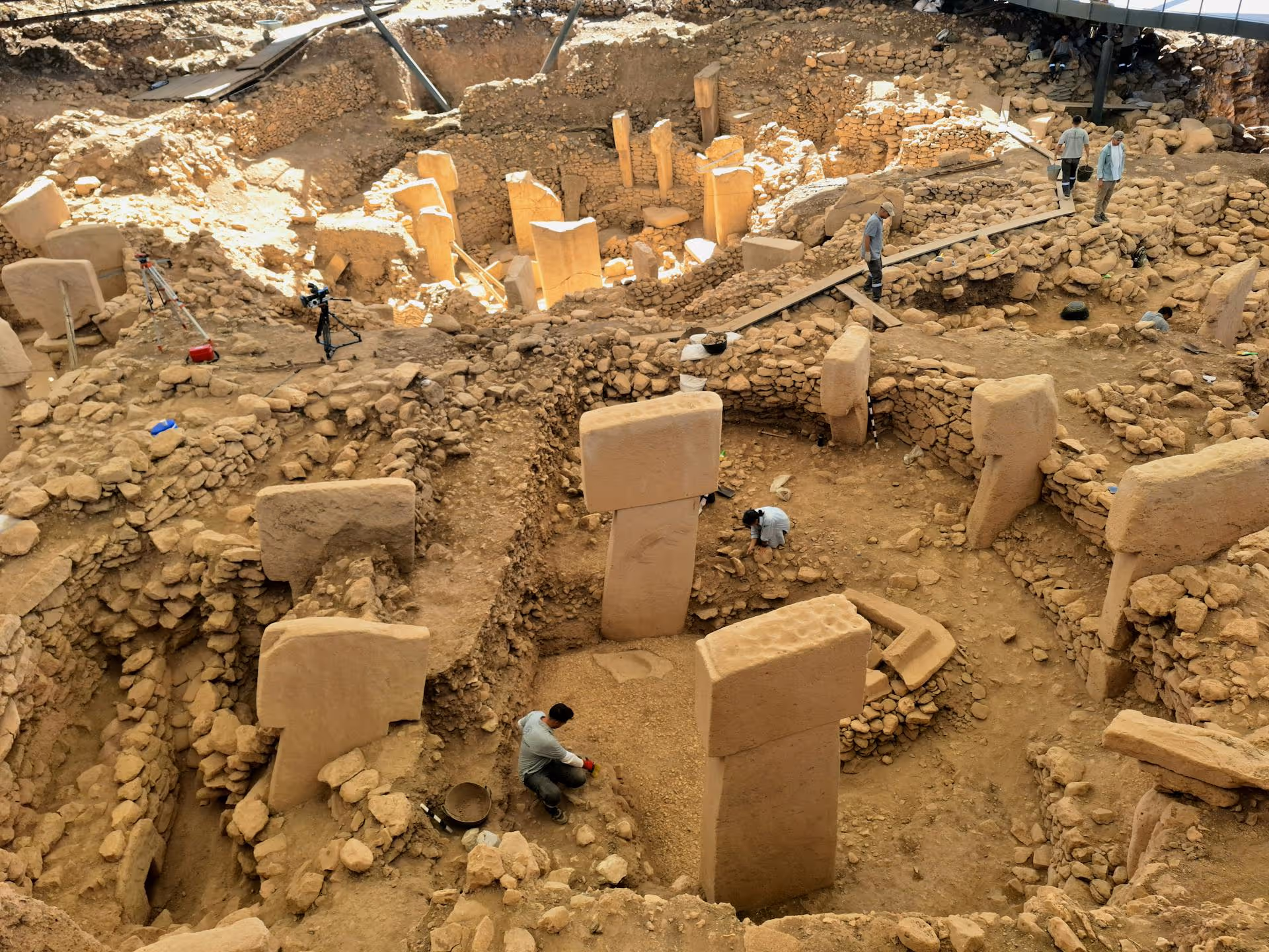
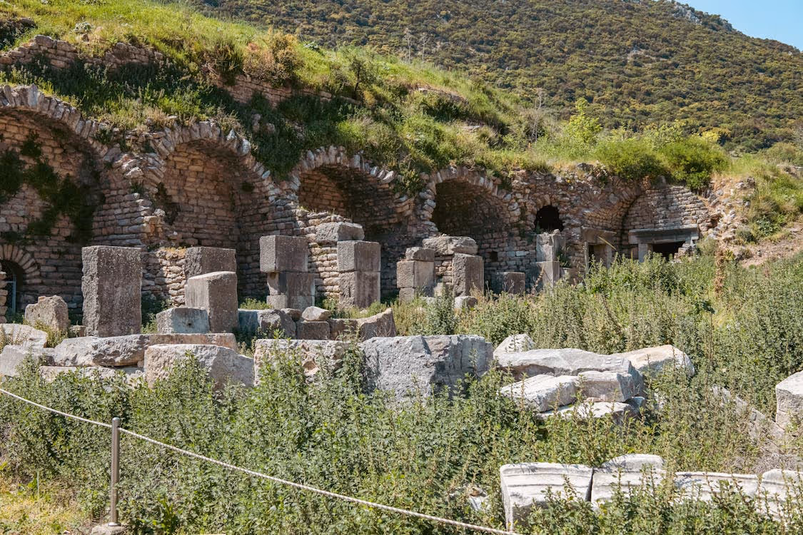
Archaeologists know that the landscape can hide as much history as it reveals. Dense vegetation and rugged mountains can make ancient features difficult to identify without a bird’s-eye view. That’s one reason why so many researchers have turned to aerial archaeology in order to gather clear historical insights without disturbing sensitive cultural sites.
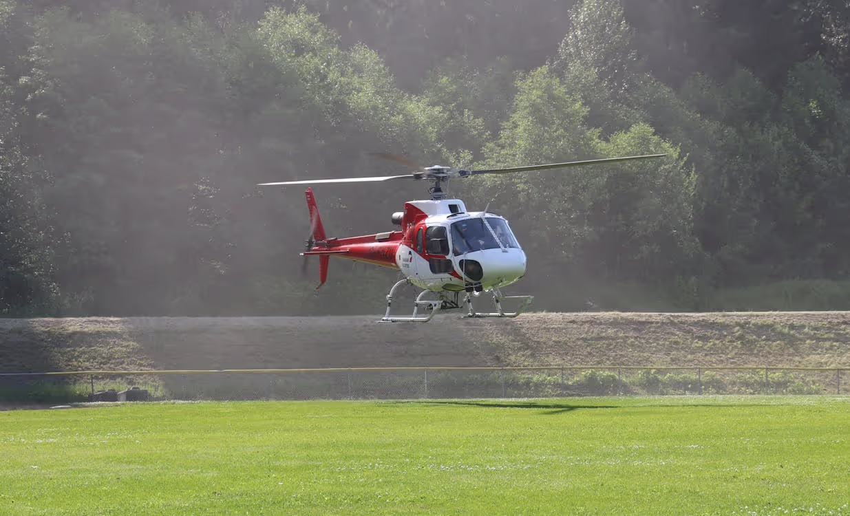
Helicopters help archaeologists cover more ground, access remote locations quickly, and capture high-quality data in a non-invasive manner. If you’re exploring new ways to assess and analyze a historical site, a helicopter-based aerial survey can provide the unique perspective you’ve been missing.
Below, we’ll walk through the basics of aerial archaeology, the key applications of aerial surveys, the essential tools used during fieldwork, and how partnering with the right aviation team can help you complete your mission safely and efficiently.
What Is Aerial Archaeology?
Aerial archaeology is the analysis and interpretation of archaeological landscapes, structures, and features that aren’t visible from the ground. Helicopters are particularly useful for capturing images and visual observations of historical sites. They can fly low, hover, carry heavy tools and equipment, and slow down for precise imaging.
This flexibility makes it easier for scientists to:
- Uncover new sites
- Document large areas quickly
- Collect detailed visuals
- Create accurate maps and 3D models
- Spot subtle variations in vegetation and soil
- Guide excavation efforts
- Monitor the condition of various sites over time
The best part? Helicopters enable surveys to be conducted without disturbing sensitive landscapes.
Key Applications of Helicopters in Modern Archaeological Site Surveys
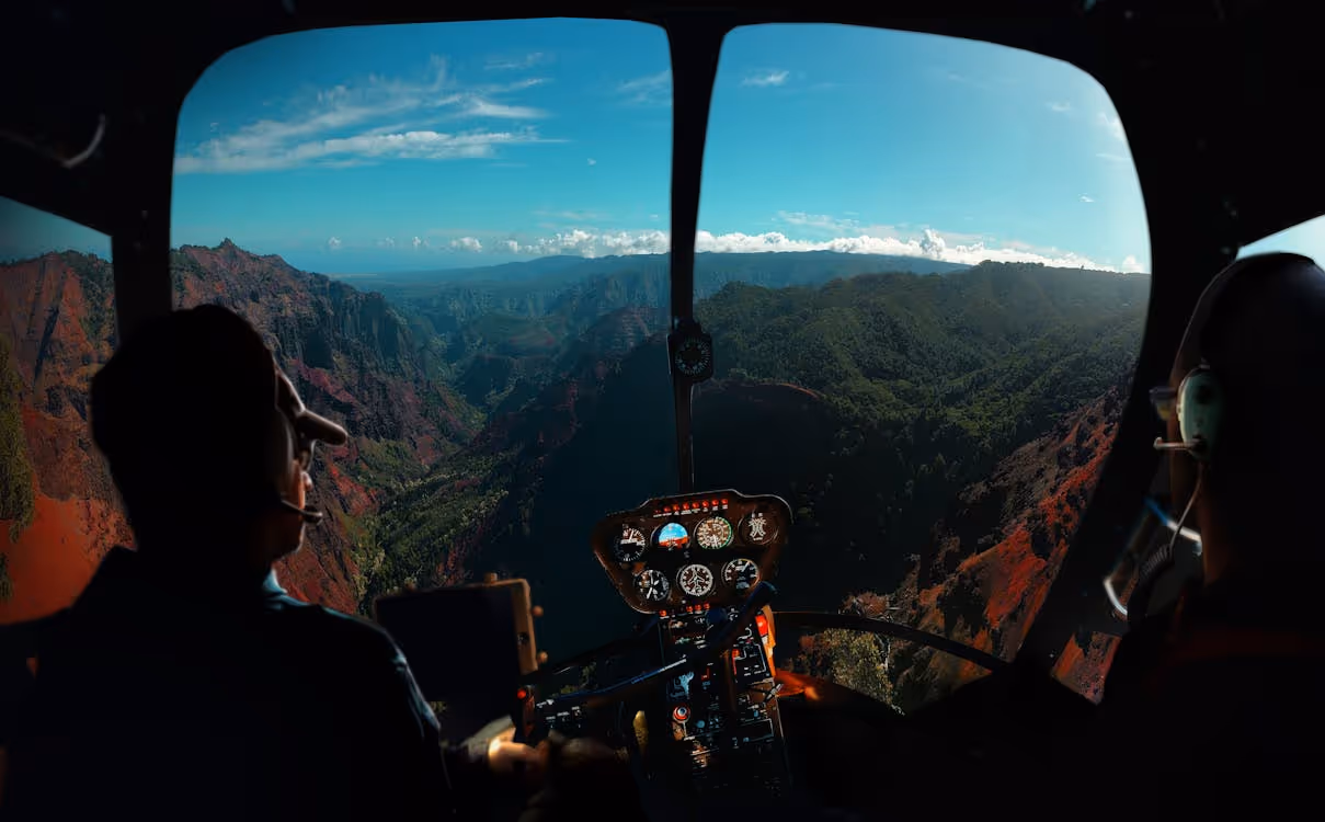
Helicopters offer a bird’s-eye view of the landscape below, making it easier for archaeologists to pinpoint patterns, monitor changes, and gather accurate site data. Below, we’ll uncover the various ways in which rotorcraft support modern archaeological work.
Aerial Site Discovery and Observation
Rotorcraft help archaeologists spot patterns and features such as walls, mounds, and geometric earthworks that largely blend into the terrain at ground level. Aerial observation makes it easier to detect variations in vegetation and soil patterns that may signal buried structures. This perspective is especially helpful in dense forests or areas where urban development makes accessibility difficult.
Aerial Surveying and Mapping
Low-altitude flights allow for the collection of high-resolution imagery used to detect landscapes and features and build digital terrain models (DTMs), orthophotos, and 3D models. This data helps archaeologists map sites to support research and preservation efforts.
Geophysical Surveys
Rotorcraft are capable of carrying instruments like ground-penetrating radar (GPR) or magnetometers that can detect subsurface anomalies. These readings help teams locate buried structures, artifacts, and pathways without disturbing fragile ground.
Landscape Analysis
Aerial reconnaissance allows archaeologists to view entire ancient landscapes at once, revealing settlement patterns, land usage, irrigation systems, and vital infrastructure. Understanding how past societies interacted with their environment answers questions about social organization, trade routes, agricultural practices, and more.
Aerial Monitoring
Helicopters make it easy for scientists to track erosion, vegetation changes, and unauthorized activity at known sites. Gathering up-to-date information through periodic monitoring allows archaeologists to determine excavation schedules and establish conservation priorities.
Conservation and Management
Aerial surveys make it easy for archaeologists to compare data over time. This helps them identify areas at risk of natural or human-caused destruction and make informed decisions about areas to prioritize and strategies for protection.
Cultural Heritage Documentation
The detailed imagery and 3D models generated through helicopter-based surveys serve as archaeological site records. These digital archives support cultural heritage education, public outreach, and future research.
Aerial Site Survey Tools
Helicopters are capable of carrying researchers and cargo and flying low and slow. But archaeologists can’t capture the data they need without a variety of specialized equipment, instruments, and tools.
LiDAR
Light detection and ranging (LiDAR) systems use laser pulses to measure distances and create highly accurate 3D models. This technology can cut through dense forest canopies and even the ground’s surface to uncover hidden structures and other topographic features. Modern LiDAR processing software helps analyze this data to create accurate maps and terrain models.
High-Resolution Cameras
Digital cameras, infrared cameras, and multispectral cameras can document crop marks, soil marks, and shadow patterns from the sky. Scientists can use these indicators to identify archaeological structures invisible to the naked eye.

Thermal Imaging Cameras
These cameras utilize infrared technology to detect subtle variations in the ground’s temperature. Because buried features retain heat differently than the surrounding soil, these variations may indicate buried structures such as underground chambers and passages.
Multispectral and Hyperspectral Imaging Systems
Multispectral and hyperspectral imaging systems capture light at multiple wavelengths to reveal subtle differences in soil composition or vegetation health. These can indicate buried roads and other archaeological structures.
Remote Sensors
Specialized magnetic, electrical, or seismic sensors mounted on helicopters can gather subsurface data without disrupting the ground. These readings are used to guide excavation plans and help research teams determine where to focus their investigations.
Benefits of Hiring a Helicopter Company for Your Archaeological Site Survey
Partnering with an aviation team like Helicopter Express can give you the access, flexibility, and technical capabilities you need to collect high-quality site data and preserve history. Here are several benefits of helicopter-based aerial surveys:
Enhanced Efficiency
Traditional archaeological surveys may require long treks through rugged terrain and hours of careful documentation. This slow, labor-intensive work limits how much ground a team can cover in a day. Helicopters can scan vast areas in a fraction of the time, capturing high-resolution imagery and site data in a single pass. This is particularly valuable when documenting widespread or hard-to-access archaeological features.
Increased Access to Difficult Terrain
Some archaeological sites are difficult or dangerous to reach on foot or by vehicle due to rough landscapes, thick forests, and unstable ground. Rotorcraft can maneuver into these areas safely, hover for precise data capture, and carry heavier equipment than a drone. This makes them an ideal solution for surveying large or isolated sites.
Reduced Environmental Impact
Because helicopters work from the air, they avoid direct contact with fragile archaeological surfaces. This minimizes site disturbance and prevents accidental damage caused by ground vehicles and heavy equipment.
Boosted Data Volume and Quality
Airborne surveys can gather massive amounts of accurate, detailed data via advanced technology systems. 3D models, site topography analysis, and hidden features provide a clearer, more accurate picture of a site.
Planning for an Aerial Archaeological Site Survey
No two site surveys are the same. The scope of work, equipment, and preparation required can vary greatly depending on the project type, the archaeologist’s role, and the site location.
However, there are a few key steps that most helicopter-assisted site surveys require:
Fieldwork Preparation
Your team will need to:
- Clarify your research goals
- Establish areas of interest
- Determine where aerial support will deliver the most meaningful results
- Select the instruments and technology you require
- Set spatial and accuracy requirements
- Choose your imaging system
- Preconfigure any camera systems
- Establish shot protocols
Coordination With the Helicopter Operator and Aviation Authorities
Before taking flight, it’s crucial to identify any legal, airspace, or land-access constraints, such as flight altitude limits, protected areas, and controlled airspaces. You may need to obtain an archaeological permit, seek permissions from landowners, or secure cultural heritage consent. Your aviation team will help you understand and obtain any necessary permits. They will also help you plan a route that complies with regulations.
Flight Planning
Seasonal and meteorological windows—along with existing aerial or satellite imagery—can help you determine the ideal survey dates and times for optimal visibility of site features.
Your dedicated helicopter crew will help you select the ideal aircraft capable of:
- Safely flying low and slow
- Hovering where permitted
- Flying for hours at a time
- Carrying the required sensors and instruments that fall within its weight and power limits
They will also help you determine a timeline, takeoff and landing locations, and flight paths.
Flight Preparation
You will need to agree on in-flight roles, communication, and procedures. Your helicopter team will implement a safety risk assessment and operational plan. Your team will take part in a pre-flight briefing with the pilot and aerial crew to cover:
- Survey objectives
- Route
- Targets
- Altitudes
- Emergency procedures
How Helicopter Express Can Help You Preserve History from Above
When your research depends on accuracy and efficiency, you need an aviation team that understands your unique needs. Helicopter Express brings over three decades of experience in aerial survey operations, low-altitude flying, and specialized equipment transport. Our pilots are highly trained, with expertise in missions requiring steady, controlled navigation through rugged landscapes.
Your dedicated project manager will work closely with your research team to create a customized plan that accounts for your project goals, timelines, and budget. Safe and effective flight paths will help you meet your scientific goals while respecting environmental sensitivities. Whether your operation involves LiDAR mapping, aerial photography, or another research method, our pilots and fleet are equipped to handle your archaeological project with care.
If you’re ready to get started, contact Helicopter Express for a quote. Let’s begin planning your aerial site survey so you can preserve history without disturbing the ground below.