Glacier Survey Operations: Helicopter-Based Climate Research

Learn how helicopters support glacier survey operations and power critical climate research with speed, precision, and quick access to remote polar terrain.

Glaciers are more than just large masses of ice – they’re some of the most powerful indicators of climate change that reveal a lot about our planet’s health. As the climate crisis accelerates, it’s become increasingly more critical for scientists to understand how glaciers move, melt, and interact with their environments. But gathering that data in remote polar regions is far from easy.

Let’s explore how helicopter-based aerial assessments and technology are transforming glacier survey operations and advancing climate research. You’ll discover how helicopters are helping scientists measure snow depth, map internal ice structures, assess expedition safety, and track warm ocean water flows that threaten glacial health. 

Whether you’re an environmental scientist, research coordinator, or member of a government agency, this guide will help you understand how helicopters can support your work and move your mission forward.

How Helicopters Support Glacier Surveys and Climate Research

Helicopters provide more than just transportation to remote regions. They operate as powerful tools that help scientists collect critical data from above, below, and all around the ice. 

Here are six key ways helicopters support glacier survey operations:

Collect Snow Depth and Distribution Data

Understanding how much snow accumulates on a glacier each year and how that snow spreads is key to predicting melt rates. Helicopters can be equipped with radar and specialized tools like Light Detection and Ranging (LiDAR) technology that create detailed images of glacial snow depth and distribution. This precise method of data collection enables researchers to return to exact locations year after year to track snow changes over time. 

Investigate and Map Internal Glacier Conditions

Glaciers are complex, multi-layered systems that are constantly shifting. To understand how they move and melt, scientists need insight into what’s happening beneath the surface. 

Helicopters equipped with ground-penetrating radar (GPR) can transmit signals through thick ice to map internal glacier structures, including the shape and depth of the bedrock below. This hidden terrain plays a vital role in guiding meltwater, shaping glacier movement, and helping researchers model future changes. By flying over vast, remote regions, helicopters make it possible to carry out large-scale surveys quickly and with precision.

Assess Glacier Safety

Safety assessments are critical before any glacier expedition on foot. Helicopter-based radar and LiDAR can help scientists and researchers uncover potential safety risks like:

  • Dangerous hidden crevasses that pose a major hazard to researchers deployed on foot
  • Thinness or ice shelf instability that could result in icefalls, surges, or avalanches
  • Glacial lakes that offer potential for outburst floods

Measure Ocean Temperatures and Salinity

Unfortunately, warm ocean saltwater accelerates glacier melt rates. Helicopters provide a precise and efficient way for researchers to measure ocean temperatures and salt levels using probes. 

Here’s how it works: 

  1. Researchers drop probes with temperature and salinity sensors through cracks in the ice or through open meltwater channels. 
  2. These probes sink toward the ocean floor, capturing temperature and salinity measurements up to a depth of 1,000 meters
  3. The probes transmit this data back to the helicopter. 

Helicopters are essential for capturing these measurements for several reasons: they move faster than ships, are capable of taking measurements through narrow ice cracks, are more cost-effective to operate than icebreakers, and they’re not impacted by sea-ice conditions.

Identify Warm Ocean Water Pathways

Warm ocean water that flows beneath or alongside glaciers contributes significantly to ice melt and sea-level rise in polar regions. Helicopters equipped with thermal imaging and sensors can fly over glaciers to detect heat signatures beneath the surface and locate where warm water is undermining glaciers from below.

For example, helicopter-based observations helped scientists identify warm ocean water pathways flowing toward the Totten Ice Shelf in East Antarctica in 2019. Scientists have used computer models of these pathways to understand how the warm water flows, predict future changes, and make decisions and policies for the prevention of climate change. 

Create Man-Made Glaciers 

One new initiative helicopters are taking on is creating man-made glaciers in places like the Cordillera in Chile. Helicopters are being used to transport materials for building artificial glaciers and strategically distributing water to form new ice masses. The goal of projects like this one is to increase water availability in the mountains and protect resources. 

Learn more about how helicopters assist conservationists in conducting crucial ocean research.
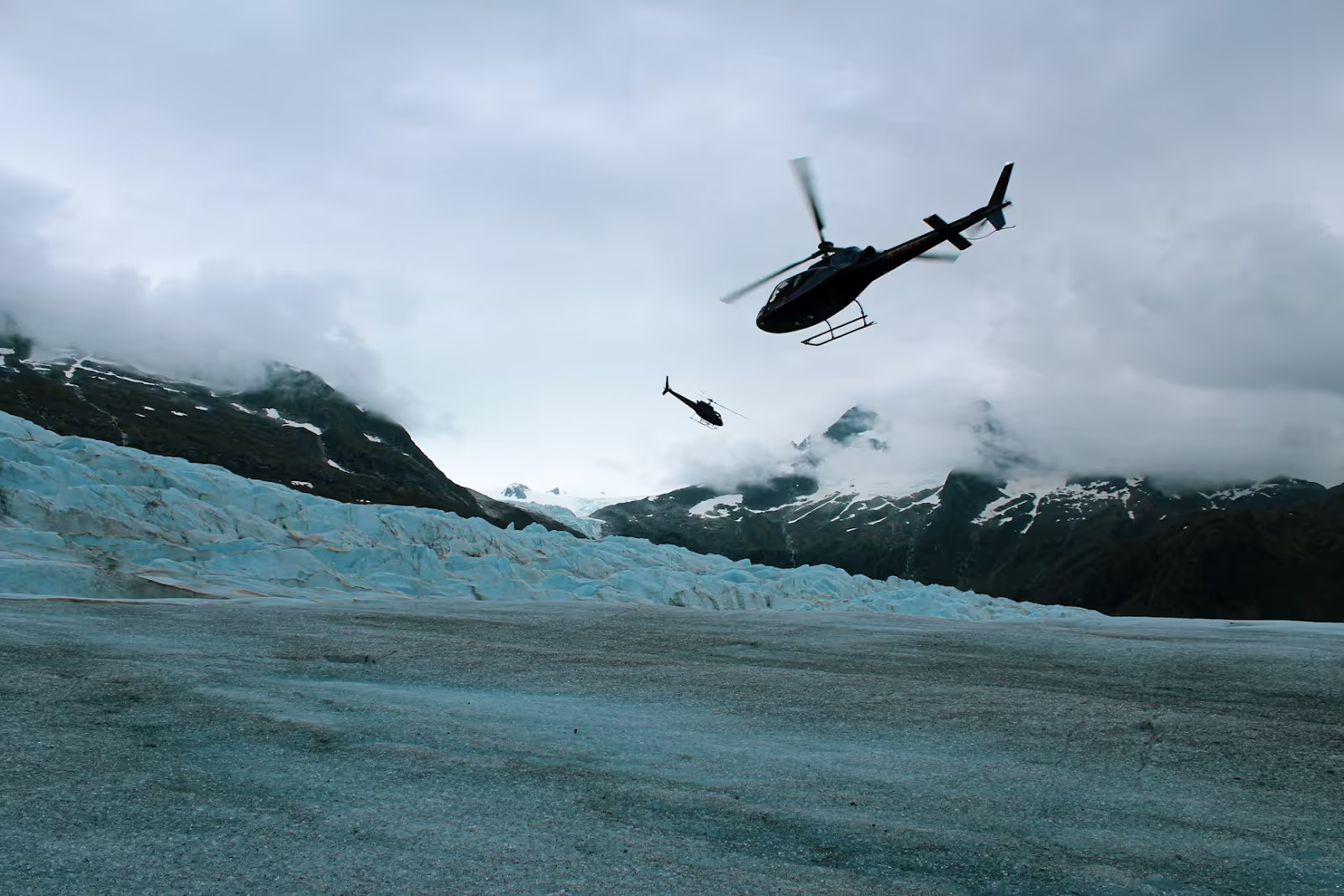
two black helicopters flying over ice-covered mountains on a cloudy day
Photo by LOGAN WEAVER | @LGNWVR from Unsplash

Advantages of Helicopter-Based Glacier Research

Using helicopters to support glacier survey operations offers numerous advantages, including:

  • Enhanced Efficiency and Speed: Researchers can cover expansive polar regions in a matter of hours, collecting data that could take weeks (or longer) on foot.
  • Access to Remote Regions: Helicopters can reach glaciers located deep within remote and rugged mountain ranges that would be impossible to reach via land or sea.
  • Cost Effectiveness for Large-Scale Surveys: Helicopters aren’t cheap, but they have proven to be more efficient for large-scale or repeated data collection missions. They’re faster than ships and far less expensive than the cost of setting up permanent off-shore infrastructure.
  • Ability to Hover: Because helicopters are capable of hovering in place, they make it easy for scientists to drop probes, deploy sensors, or conduct quick aerial surveys and assessments.
  • Advanced Technology: Helicopters can carry or be equipped with specialized tools and instruments that enable scientists to gather rich, accurate glacial data. Cutting-edge equipment includes LiDAR, ground-penetrating radar, hyperspectral cameras, and more.
  • Minimal Environmental Impact: Helicopters can fly directly to glaciers, collect data, and return to the shore without leaving a lasting footprint. Helicopter-based glacier survey operations are far less intrusive than ship-based expeditions in fragile glacier ecosystems.
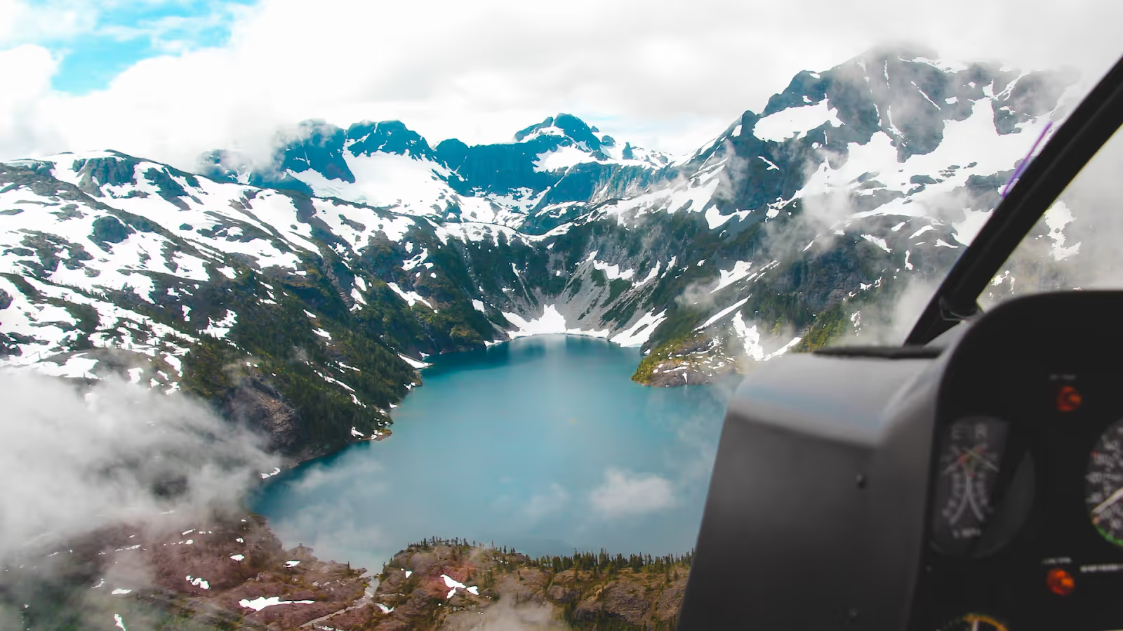
view of snowy mountains and a glacial lake from inside a helicopter cockpit
Photo by Zac Anderson from Unsplash

Challenges and Limitations of Helicopter-Based Glacier Climate Research

Helicopters are precise and powerful climate research tools, but they’re not without certain limitations.

  • Cost: While helicopters are often the most cost-efficient method of collecting data in remote regions, they do require a significant up-front investment. Your helicopter service partner will help you plan your mission carefully to maximize your flight time and data yield.
  • Weather Restrictions: Weather changes quickly in glacial regions, and helicopter operations can be impacted by challenging weather conditions like snowstorms, fog, high winds, and icing. However, experienced helicopter teams know how to use advanced anti-icing systems, meticulous flight plans, and other proactive cold-weather strategies to tackle these weather-related obstacles.
  • Impacted Radar Signal Quality: Unfortunately, rough terrain, snow, and ice layers can impact radar signals. But skilled pilots know how to adjust flight paths as necessary to improve data capturing.

  • Complex Logistics: It can be challenging to coordinate permits, flight schedules, fuel supply, and equipment transportation in remote areas. One of the benefits of working with an expert helicopter service company is that your team will have experience streamlining these complex logistics. When you work with Helicopter Express, our skilled crew will handle permitting, plan efficient flight routes, coordinate fuel drops, and ensure your equipment gets where it needs to go – safely, on time, and on budget.

Join Forces with Helicopter Express. Let’s Work Together Toward a Healthier Planet.

At Helicopter Express, we understand the high stakes of climate research and the flexibility and precision it demands. Our elite pilots, versatile fleet, and customized solutions have supported scientists and researchers on critical missions across the U.S. and around the globe.

We offer tailored support for environmental missions, including glacier surveys, aerial LiDAR operations, remote probe deployment, and more. Whether your project involves ocean temperature measurements or mapping subglacial structures in the depths of Alaska, our team will provide the talent, equipment, and logistical support you need to tackle climate change.

If you’re ready to take your glacier research to the next level, contact Helicopter Express today.

Glacier Survey Operations: Helicopter-Based Climate Research

Glaciers are more than just large masses of ice – they’re some of the most powerful indicators of climate change that reveal a lot about our planet’s health. As the climate crisis accelerates, it’s become increasingly more critical for scientists to understand how glaciers move, melt, and interact with their environments. But gathering that data in remote polar regions is far from easy.

Let’s explore how helicopter-based aerial assessments and technology are transforming glacier survey operations and advancing climate research. You’ll discover how helicopters are helping scientists measure snow depth, map internal ice structures, assess expedition safety, and track warm ocean water flows that threaten glacial health. 

Whether you’re an environmental scientist, research coordinator, or member of a government agency, this guide will help you understand how helicopters can support your work and move your mission forward.

How Helicopters Support Glacier Surveys and Climate Research

Helicopters provide more than just transportation to remote regions. They operate as powerful tools that help scientists collect critical data from above, below, and all around the ice. 

Here are six key ways helicopters support glacier survey operations:

Collect Snow Depth and Distribution Data

Understanding how much snow accumulates on a glacier each year and how that snow spreads is key to predicting melt rates. Helicopters can be equipped with radar and specialized tools like Light Detection and Ranging (LiDAR) technology that create detailed images of glacial snow depth and distribution. This precise method of data collection enables researchers to return to exact locations year after year to track snow changes over time. 

Investigate and Map Internal Glacier Conditions

Glaciers are complex, multi-layered systems that are constantly shifting. To understand how they move and melt, scientists need insight into what’s happening beneath the surface. 

Helicopters equipped with ground-penetrating radar (GPR) can transmit signals through thick ice to map internal glacier structures, including the shape and depth of the bedrock below. This hidden terrain plays a vital role in guiding meltwater, shaping glacier movement, and helping researchers model future changes. By flying over vast, remote regions, helicopters make it possible to carry out large-scale surveys quickly and with precision.

Assess Glacier Safety

Safety assessments are critical before any glacier expedition on foot. Helicopter-based radar and LiDAR can help scientists and researchers uncover potential safety risks like:

  • Dangerous hidden crevasses that pose a major hazard to researchers deployed on foot
  • Thinness or ice shelf instability that could result in icefalls, surges, or avalanches
  • Glacial lakes that offer potential for outburst floods

Measure Ocean Temperatures and Salinity

Unfortunately, warm ocean saltwater accelerates glacier melt rates. Helicopters provide a precise and efficient way for researchers to measure ocean temperatures and salt levels using probes. 

Here’s how it works: 

  1. Researchers drop probes with temperature and salinity sensors through cracks in the ice or through open meltwater channels. 
  2. These probes sink toward the ocean floor, capturing temperature and salinity measurements up to a depth of 1,000 meters
  3. The probes transmit this data back to the helicopter. 

Helicopters are essential for capturing these measurements for several reasons: they move faster than ships, are capable of taking measurements through narrow ice cracks, are more cost-effective to operate than icebreakers, and they’re not impacted by sea-ice conditions.

Identify Warm Ocean Water Pathways

Warm ocean water that flows beneath or alongside glaciers contributes significantly to ice melt and sea-level rise in polar regions. Helicopters equipped with thermal imaging and sensors can fly over glaciers to detect heat signatures beneath the surface and locate where warm water is undermining glaciers from below.

For example, helicopter-based observations helped scientists identify warm ocean water pathways flowing toward the Totten Ice Shelf in East Antarctica in 2019. Scientists have used computer models of these pathways to understand how the warm water flows, predict future changes, and make decisions and policies for the prevention of climate change. 

Create Man-Made Glaciers 

One new initiative helicopters are taking on is creating man-made glaciers in places like the Cordillera in Chile. Helicopters are being used to transport materials for building artificial glaciers and strategically distributing water to form new ice masses. The goal of projects like this one is to increase water availability in the mountains and protect resources. 

Learn more about how helicopters assist conservationists in conducting crucial ocean research.

two black helicopters flying over ice-covered mountains on a cloudy day
Photo by LOGAN WEAVER | @LGNWVR from Unsplash

Advantages of Helicopter-Based Glacier Research

Using helicopters to support glacier survey operations offers numerous advantages, including:

  • Enhanced Efficiency and Speed: Researchers can cover expansive polar regions in a matter of hours, collecting data that could take weeks (or longer) on foot.
  • Access to Remote Regions: Helicopters can reach glaciers located deep within remote and rugged mountain ranges that would be impossible to reach via land or sea.
  • Cost Effectiveness for Large-Scale Surveys: Helicopters aren’t cheap, but they have proven to be more efficient for large-scale or repeated data collection missions. They’re faster than ships and far less expensive than the cost of setting up permanent off-shore infrastructure.
  • Ability to Hover: Because helicopters are capable of hovering in place, they make it easy for scientists to drop probes, deploy sensors, or conduct quick aerial surveys and assessments.
  • Advanced Technology: Helicopters can carry or be equipped with specialized tools and instruments that enable scientists to gather rich, accurate glacial data. Cutting-edge equipment includes LiDAR, ground-penetrating radar, hyperspectral cameras, and more.
  • Minimal Environmental Impact: Helicopters can fly directly to glaciers, collect data, and return to the shore without leaving a lasting footprint. Helicopter-based glacier survey operations are far less intrusive than ship-based expeditions in fragile glacier ecosystems.

view of snowy mountains and a glacial lake from inside a helicopter cockpit
Photo by Zac Anderson from Unsplash

Challenges and Limitations of Helicopter-Based Glacier Climate Research

Helicopters are precise and powerful climate research tools, but they’re not without certain limitations.

  • Cost: While helicopters are often the most cost-efficient method of collecting data in remote regions, they do require a significant up-front investment. Your helicopter service partner will help you plan your mission carefully to maximize your flight time and data yield.
  • Weather Restrictions: Weather changes quickly in glacial regions, and helicopter operations can be impacted by challenging weather conditions like snowstorms, fog, high winds, and icing. However, experienced helicopter teams know how to use advanced anti-icing systems, meticulous flight plans, and other proactive cold-weather strategies to tackle these weather-related obstacles.
  • Impacted Radar Signal Quality: Unfortunately, rough terrain, snow, and ice layers can impact radar signals. But skilled pilots know how to adjust flight paths as necessary to improve data capturing.

  • Complex Logistics: It can be challenging to coordinate permits, flight schedules, fuel supply, and equipment transportation in remote areas. One of the benefits of working with an expert helicopter service company is that your team will have experience streamlining these complex logistics. When you work with Helicopter Express, our skilled crew will handle permitting, plan efficient flight routes, coordinate fuel drops, and ensure your equipment gets where it needs to go – safely, on time, and on budget.

Join Forces with Helicopter Express. Let’s Work Together Toward a Healthier Planet.

At Helicopter Express, we understand the high stakes of climate research and the flexibility and precision it demands. Our elite pilots, versatile fleet, and customized solutions have supported scientists and researchers on critical missions across the U.S. and around the globe.

We offer tailored support for environmental missions, including glacier surveys, aerial LiDAR operations, remote probe deployment, and more. Whether your project involves ocean temperature measurements or mapping subglacial structures in the depths of Alaska, our team will provide the talent, equipment, and logistical support you need to tackle climate change.

If you’re ready to take your glacier research to the next level, contact Helicopter Express today.

Make us your go-to team.

Our highly skilled pilots have the experience and equipment needed to rise to any challenge. When you need experts you can trust, give us a call.